Mid-Atlantic and Southern New England: NEAMAP Nearshore Trawl Survey
The NEAMAP Near Shore Trawl Survey is a fishery-independent survey designed to collect information on the late juvenile and adult stages of the majority of the finfish species and several of the invertebrate species inhabiting the near shore waters of the Mid-Atlantic Bight (inshore of the 10fm contour), Block Island Sound, and Rhode Island Sound. At a minimum, this survey can provide relative abundance, both in terms of number and biomass, and length-frequency information for all species collected by the survey gear. For species of management interest (i.e., those managed by the Mid-Atlantic Council, New England Council, and ASMFC), additional information including length-weight, sex ratio, size- and age-at-maturity, age-structure, size-at-age, and diet (to name a few) will be available.
These data can be incorporated into both single-species and multispecies assessments and used in conjunction with the information generated by the NMFS/NEFSC surveys to produce a more complete picture of the status of fisheries resources in the Mid-Atlantic and Southern New England. The NEAMAP survey design, sampling methods, and subsequent data handling and analysis were approved through a peer review completed in February 2009 (ASMFC 2009).

Survey Design
Timing: NEAMAP was designed to conduct two cruises each year (spring and fall), timed to approximately correspond with traditional NEFSC surveys. The NEAMAP spring survey will occur from mid-April to mid-May, which is later than the NEFSC spring survey in the Mid-Atlantic and Southern New England (late February/early March) and will allow time for species of interest to migrate into the NEAMAP sampling area. The NEAMAP fall survey (mid-September to late-October) will coincide with the NEFSC fall survey in the Mid-Atlantic and Southern New England (September) since species of management interest are concentrated in the NEAMAP survey area during the early fall, and it is considered particularly important to obtain near-simultaneous cross-shelf samples during this season.
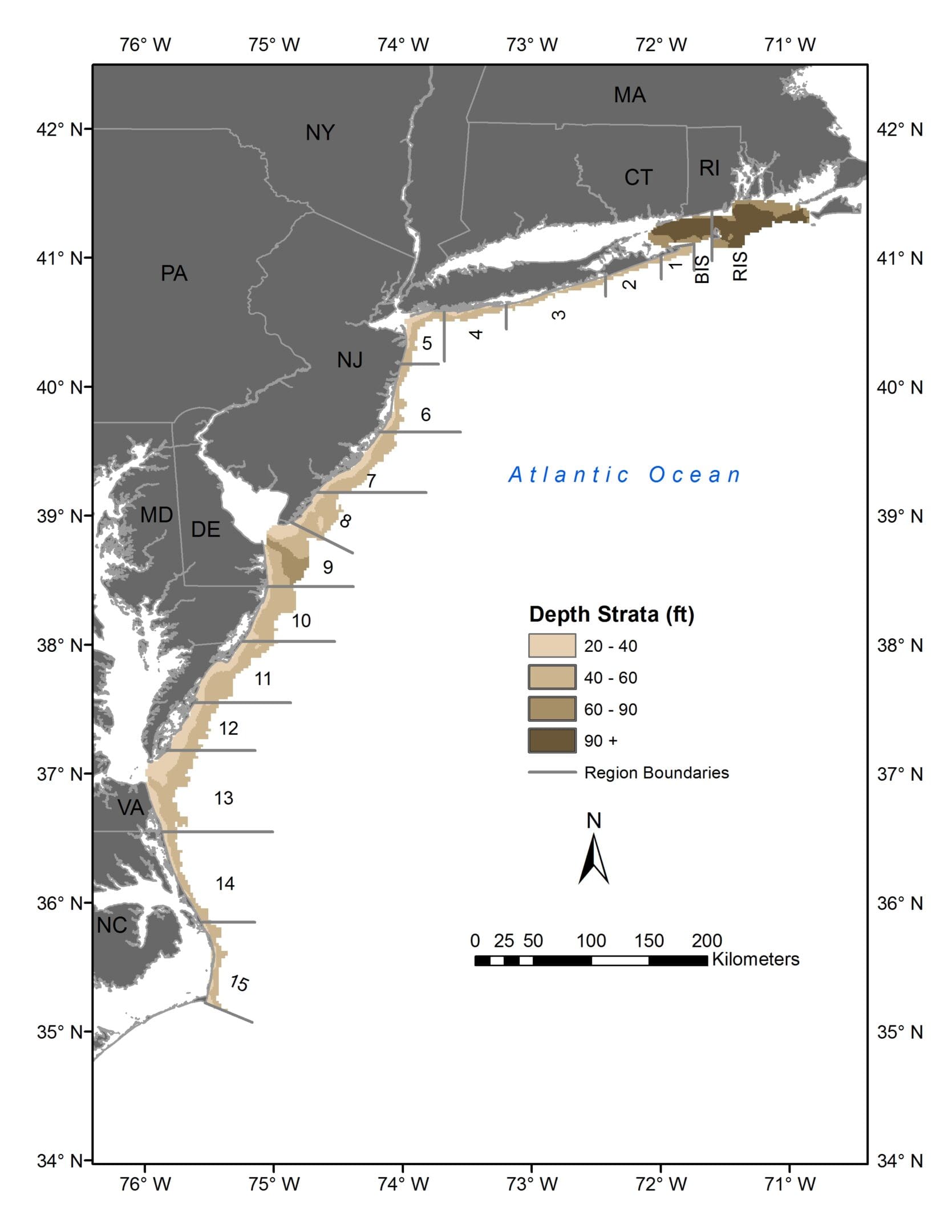
Sampling area & sites: All sampling will occur between Martha’s Vineyard, MA and Cape Hatteras, NC. West and south of Montauk, NY, sampling will be conducted in waters between the 3.3 fm and 10 fm depth contours. In Rhode Island Sound and Block Island Sound, sites will be sampled between the 10 fm and 20 fm contours. A total of 150 stations (~1 per 30 nm²) will be sampled during each cruise. Sites are selected according to a stratified random design, with strata defined by latitudinal/longitudinal regions and depth. Regional strata are closely aligned to historical NMFS designations, which generally correspond both to state boundaries and to estuarine outflows. Within each region, depth strata have been established so as to assure sampling throughout the depth profile and sufficient inshore-to-offshore coverage. The total NEAMAP sampling area is divided into approximately 2,000 sampling cells measuring 1.5 nm x 1.5 nm each; these cells represent the sampling units. The number of sites allocated to a given region/depth stratum for each cruise is roughly proportional to the surface area of that stratum. Some flexibility is allowed with regard to the starting position and track of each tow, since logistical considerations (known ‘hangs,’ surface traffic, current, etc.) can at times influence one or both. However, to further remove the possibility of bias in selecting an anticipated tow track, during 2013 VIMS implemented a system which randomly assigns one of the ‘corners’ of a sampling cell from which a tow should start. A valid tow is one that remains within the cell and maintains the appropriate depth profile.
Vessel
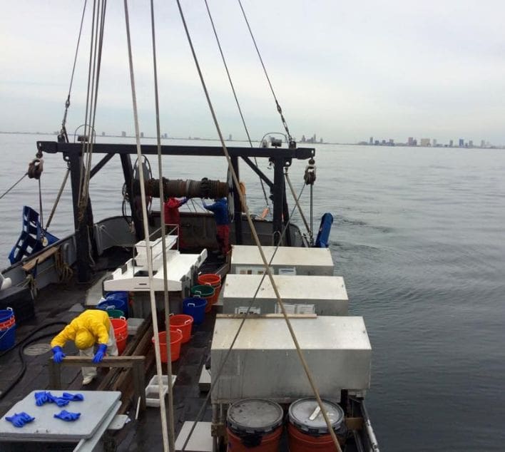
All previous NEAMAP survey cruises have been performed in cooperation with Captain Robert Ruhle aboard the F/V Darana R. This particular partnership has worked extremely well and the captain and crew are at least as responsible for the successful execution of the previous surveys as are the scientific personnel.
Fishing System

To assure comparability with NEFSC surveys conducted from the FSV Bigelow, NEAMAP selected the bottom trawl developed for the NEFSC by the joint Mid-Atlantic/New England Trawl Survey Advisory Panel. A full description of the net design, along with technical plans, is available in the NEAMAP peer review documents (Bonzek et al. 2008). This fishing system was successfully used during the NEAMAP pilot cruise and all subsequent full-scale surveys. The NEAMAP net/door combination, fished aboard the chosen vessel, has performed as intended (with respect to geometry and consistency) within tows, among tows, and across surveys. It also appears to collect a representative sample of a wide variety of species, both managed and unmanaged.
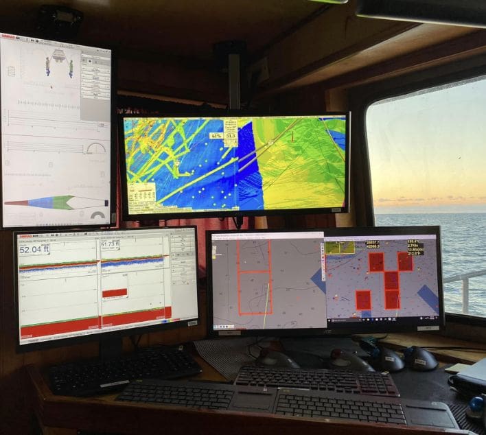
With respect to trawl monitoring, from the pilot survey in 2006 until Spring 2017, the NEAMAP Survey has used a Netmind system manufactured by Northstar Technical, Inc. During fishing operations, acoustic sensors provide near-real-time measures of gear performance, enabling the Captain and crew to adjust tow speeds and scope to obtain the optimum geometry of the net. Equally important, these data are saved to computer files which, when combined with tow distance information from the GPS, allow subsequent data analyses (such as the generation of abundance estimates) to be performed on an area-swept basis. Such analyses provide standard adjustments for any tow-to-tow differences in tow speed, tow duration, current speed, etc. NEAMAP upgraded to the Simrad PX Trawl Monitoring System prior to the Spring 2017 survey.
More information about the trawl net and its design can be found here.
Sampling Operations
All fishing operations will be conducted during daylight hours. Each tow will be 20 minutes in duration, with tow duration measured as the time from which the winch brakes are engaged to the time that the brakes are released. The target vessel speed over ground for each tow will be 3.0 knots though depending upon current direction and speed, the vessel speed is adjusted to assure that the net is fishing within its proper height and width ranges. Flume tank and field testing have demonstrated that the fishing system performs well at this speed, and that performance is also acceptable above and below that speed.
At each station, several parameters will be recorded. These include (but are not limited to):
- Station identification parameters - date, station number, and stratum.
- Tow parameters - beginning & ending tow location, vessel speed & direction, engine RPMs, duration of tow, water depth, tidal stage.
- Gear identification & operational parameters - net type & number, door type & numbers, tow warp length, trawl door spread, wing spread, headline height & bottom contact.
- Atmospheric & weather data - air temperature, wind speed & direction, barometric pressure, relative humidity, general weather state, sea state.
- Hydrographic data - water temperature, salinity, dissolved oxygen (each recorded at 2m increments between surface and bottom).
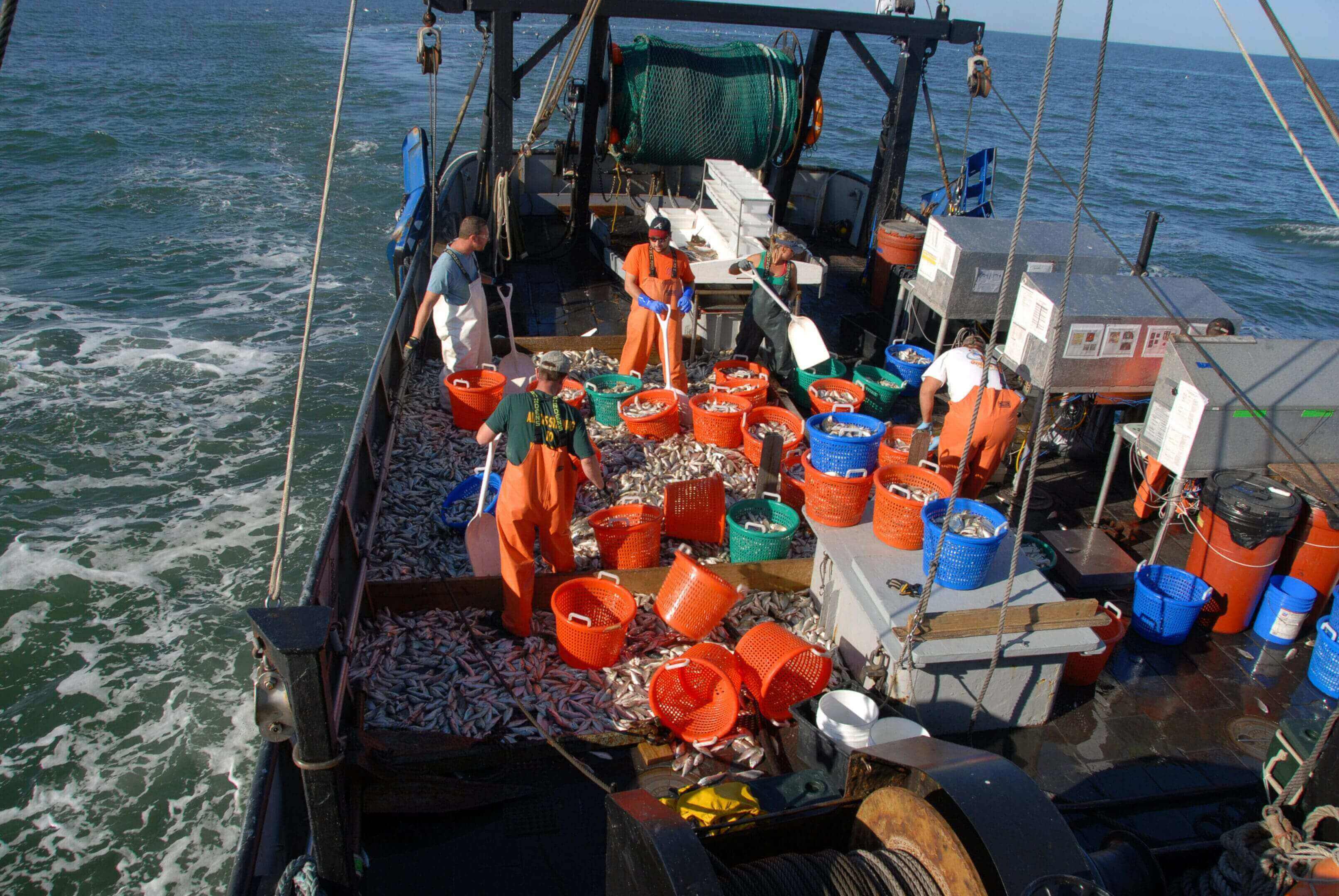
After the completion of each tow, the catch will be sorted by species and modal size groups. For species of management interest, a subsample from each size group will be selected for ‘complete processing’. Previous analyses have shown that a subsample of three to five individuals per species/size group per tow is sufficient for this full processing. The data collected from each of these subsampled specimens will include length, weight (whole and eviscerated), sex (macroscopic), and maturity stage (macroscopic). Stomachs will be removed, and those containing prey will be preserved onboard for subsequent examination by survey personnel at the VIMS shore-based laboratory. Otoliths or other appropriate ageing structures (e.g., opercles, vertebrae, spines, etc.) will also be taken for later age determination. For specimens not selected for this full processing, either because they belonged to a non-priority species or were a priority but a sufficient subsample of that species had already been selected, aggregate weights will be recorded by species/size group. Individuals will then be enumerated as length measurements are taken for either all or a representative subsample.
Crew
The vessel crew will be responsible for safe operation of the vessel and the fishing gear, the costs of which will be included in the vessel charter. The scientific crew of five persons will be responsible for all catch processing and data collection efforts described above (sometimes supported by the vessel crew).
Lab Analysis
Upon completion of the field portion of the NEAMAP Survey, all samples that require additional processing (i.e., stomachs for diet analysis and hard parts for ageing) will be transported to VIMS. Current survey staff are well versed in the preparation and analysis of these samples, with approximately 40+ years of experience among them. To date, over 150,000 hard parts were sampled for age determination while over 100,000 stomachs were collected. As of December 2023, 102,108 ageing samples and 97,208 stomach samples have been processed. The majority of the remaining samples are from various elasmobranch species which require time consuming preparation and for which ageing protocols are generally less well defined than for most teleost fishes.
Data Products
Data resulting from the NEAMAP surveys will be extensive. Within weeks of the conclusion of field operations, the set of available data summaries will include:
- Biomass abundance estimates for each species, expressed in a variety of possible units including (but not limited to) stratified geometric mean of catch per standard area swept and minimum trawlable biomass in the survey area. These estimates can be expressed over the entire survey area, or by subsection, as appropriate.
- Numerical abundance estimates for each species, expressed in a variety of possible units including (but not limited to) stratified geometric mean of catch per standard area swept and minimum trawlable number in the survey area. These estimates can be expressed over the entire survey area, or by subsection, as appropriate.
- Spatial distribution maps for each species, prepared using Geographic Information System (GIS) programs, showing relative abundance distribution over the survey area.
- Length-frequency graphs for each species and, as appropriate, for subsets of each.
- Length-weight relationships for managed species and, as appropriate, for subsets of each.
- Length-at-maturity analyses for managed species, by sex.
- Sex ratios for managed species and, as appropriate, for subsets of each species (e.g., by length).
Within six to eight months (depending on the number of samples collected) of the conclusion of field operations, much of the age and diet data will be available, supporting additional summaries including:
- Age distribution graphs (and catch curves) for managed species, and subsets of each.
- Age specific abundance indices for some species, expressed in terms of number and biomass.
- Growth curves (e.g., von Bertalanffy) for managed species, and subsets of each.
- Sex ratios and percent mature by age class for managed species, and subsets of each.
- Diet composition for managed species, expressed as percent by weight, percent by number, and percent frequency of occurrence.
Outreach
In an effort to share survey information with interested parties, such as fishery managers, fishermen and those involved in support industries, other scientists, political figures, students, and the general public, NEAMAP staff use a multi-faceted approach. The centerpiece of these efforts is the survey ‘demonstration tows’, where guests are invited to observe sampling operations firsthand for a few hours at sea. During these events, past project reports, current data summaries, and informational brochures are available. To date, over 250 individuals from Massachusetts to North Carolina have participated, and these ‘demonstration tows’ are expected to continue through 2024 and beyond. Outside of the demonstrations, dockside interactions have proven to be an excellent way to share NEAMAP survey data with the fishing communities, and these will continue. More formally, the ASMFC maintains the official NEAMAP website, which contains an array of background information on the survey and past reports and is expected to offer much more data in the near future. Finally, staff have made thorough presentations of NEAMAP results at several Mid-Atlantic Fishery Management Council, New England Fishery Management Council, and ASMFC meetings to date. These efforts will continue.
Data Storage and Accessibility
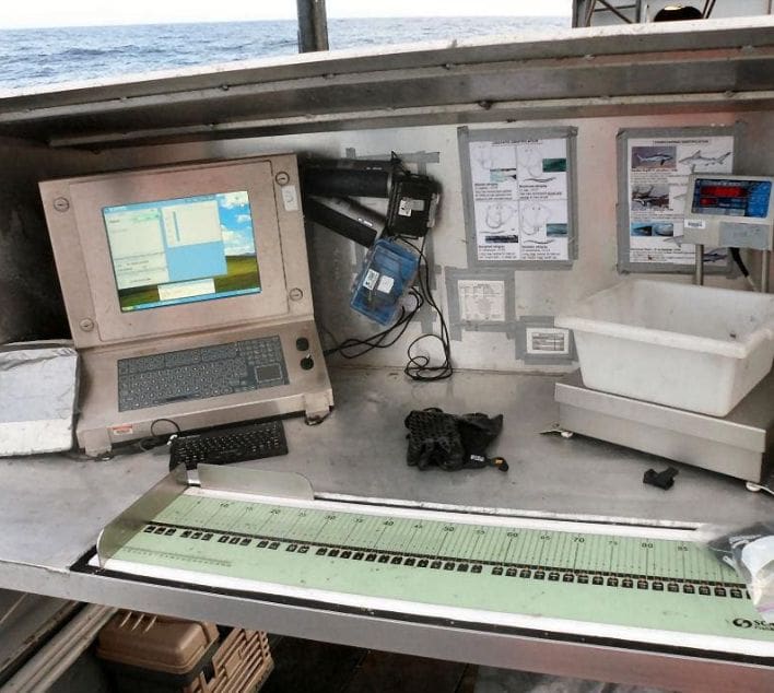
The Virginia Institute of Marine Science and its Multispecies Research Group (MRG) recognize that the funds which support NEAMAP are publicly derived and therefore VIMS has an inherent responsibility to make the data collected by the program widely available. At the same time, large amounts of both intellectual and physical energies are exerted by VIMS personnel to collect and manage these data and VIMS considers there to be a significant level of academic ownership of the data as well.
Data Sharing Policy
The general policy on data sharing adopted by the Multispecies Research Group at the Virginia Institute of Marine Science is:
- All requests for data by NOAA, ASMFC and its member states, and contracted institutions and individuals which relate directly to stock assessments and/or management of managed species are filled immediately and in full. Such institutions and individuals will have full access to as much of the data as is required to fulfill their mandate.
- Requests for data from NOAA, ASMFC and its member states, and other governmental bodies with fishery science or fishery management mandates which do not relate directly to stock assessments will be evaluated on a case-by-case basis. For such requests, the ‘default’ response will be to provide such data as are required by the researcher(s) but the requests will be evaluated to assure that providing the data would not conflict with analyses underway or planned within the near future by MRG. The evaluation criteria will also account for possible interaction with ongoing assessments.
- Requests for data from individuals representing other academic institutions, advocacy organizations, private research foundations, and similar organizations, as well as individual citizens will be evaluated on a case-by-case basis. The criteria will be the same as those as described above.
For all requests for which data are provided, MRG will also provide as much documentation and follow-up support as users may require in order to make good and proper use of NEAMAP data.
Online Data Products
VIMS and the MRG currently provide an extensive and growing amount of data online and without restriction. The data products currently available include:
- Annual indices of abundance expressed in both numbers and biomass.
- Several other data summaries including items such as GIS based catch rates figures,
- length frequency charts, age distribution graphs, sex ratios and maturity schedules, and diet indices. Not all data types are available for all species.
- GIS based user-selectable catch histories for at each sampling location.
- Fish food habits calculations from a user-selectable database. Users can select data to be summarized over several different levels of aggregation.
Data Management
During research cruises, the biological data being collected (counts, lengths, biomass, etc.) are backed up every 20 minutes.
This assures that should there be a critical failure not more than one station’s data will be lost. All data, biological, hydrographic, physical, net mensuration, etc. are backed up at the conclusion of each sampling day.
Data from NEAMAP cruises undergo extensive error-checking routines both during research cruises and especially at the conclusion of each cruise. The number and quality of such checks is constantly under revision and improvement.
Data collected by the MRG are stored in MS Access relational data bases. Copies are kept (at a minimum) on the desktop computers of the Principal Investigators. The Master copies are kept on the Departmental server(s) which is/are equipped with redundant drives, power, etc. Server computers are housed in facilities managed by the VIMS Information Technology and Network Services unit, located separately from MRG personnel and computers. Master copies are backed up weekly and storage media are taken off site.
Required Permits and Waivers: For past NEAMAP surveys, VIMS obtained all necessary state collection permits and federal letters, including National Environmental Policy Act (NEPA) approvals, Letters of Acknowledgement (LOAs), and EFPs. No known impediments are expected for obtaining similar permits and documents for 2024.
Participating Vessel: VIMS currently has a contract with Captain Robert Ruhle for use of the vessel F/V Darana R for sampling activities. This contract provides for a daily vessel charge rate and separate reimbursement for fuel charges. A copy of the contract is available.
Environmental Compliance: All appropriate Institutional Animal Care and Use Committee (IACUC) reviews have been approved for this project for 2006-2024. It is anticipated that reviews will result in approvals for 2024 as well. NEAMAP staff also obtained NEPA approvals each year from 2006-2024, and no impediments are expected with respect to securing approvals for 2024.


Contact
This survey is run by the Virginia Institute of Marine Science’s Multispecies Research Group.
For more information, please reach out to Jameson Gregg.
