Maine-New Hampshire Inshore Trawl Survey
The Maine-New Hampshire Inshore Bottom Trawl Survey (MENH Survey) is a biannual fishery-independent survey conducted in the spring and fall of every year to assess marine resources in inshore waters of Maine and New Hampshire. The MENH survey is a collaborative survey working with commercial fishermen to complete the survey and uses a commercial fishing vessel as the research platform. This survey provides data to support and improve management of various marine resources in an area that was not previously surveyed before the start of this project.

Station Selection

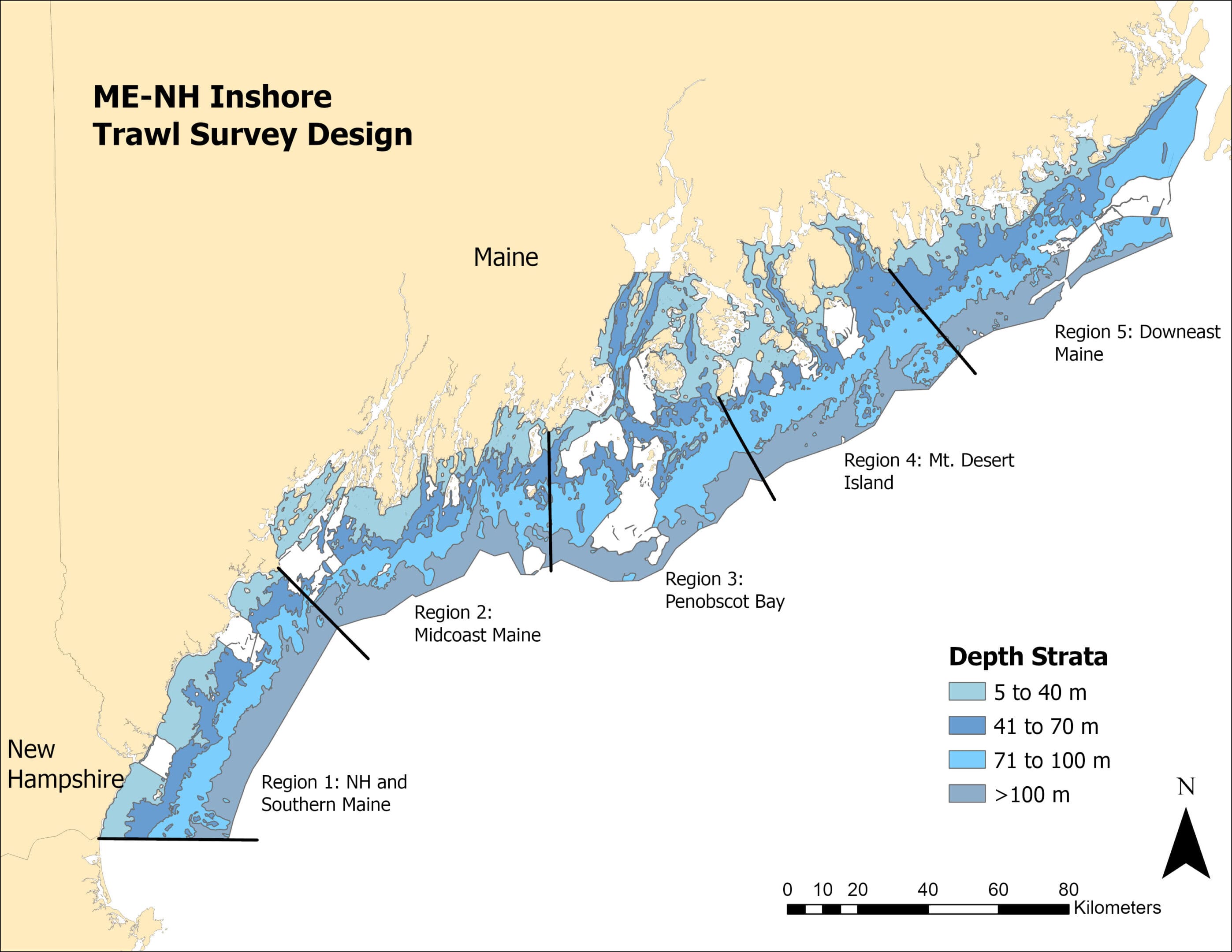
Prior to each survey, random stations are selected from a NOAA nautical chart in ArcProTM GIS overlain with 1-NM² grids. Each grid within each region is assigned a unique identification number that serves as a call number. Grids are selected using a random number generator code in the R statistical software. Tows approximately 1 NM long are proposed within each randomly selected grid. From prior experience and local knowledge, some grids are classified as untowable in which case tows are sought in adjacent grids. If no towable bottom can be found within a 2-mile radius, a new random number is chosen within the same stratum. Tows are plotted in latitude/longitude degrees to the nearest 0.001 decimal minutes.
Vessel
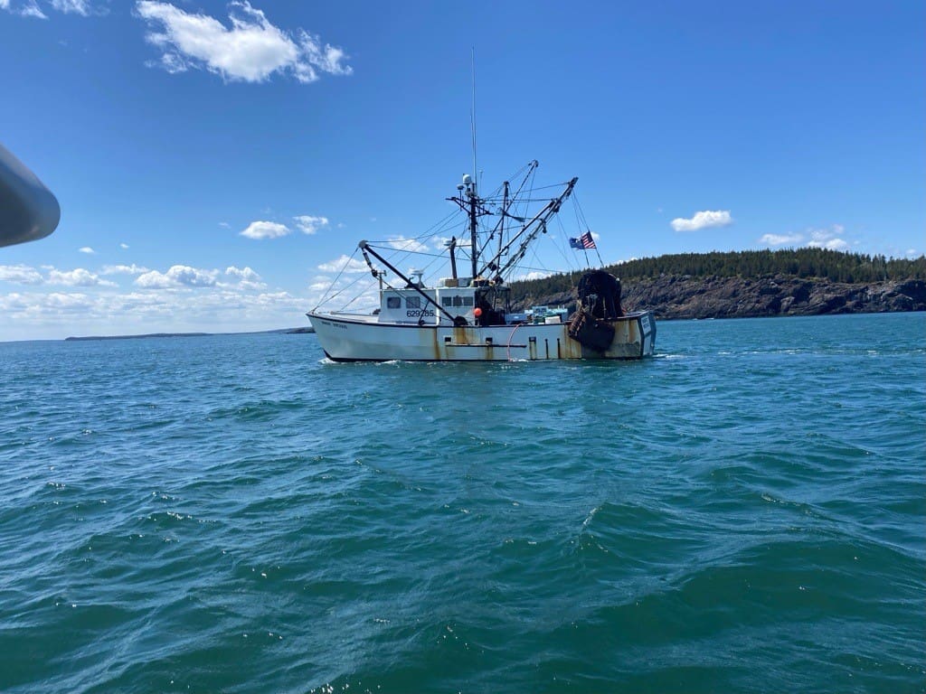
The F/V Robert Michael, vessel used for the survey, is a Down East 54 constructed of a combination of solid and sandwich fiberglass and powered by an 8-cylinder 365 H.P GMC diesel. Reverse gear is a Twin Disc, Model 514, with a 4.5 to 1 ratio. A 3-inch stainless steel shaft turns a 47 x 45-inch, 4-bladed power propeller housed in a 48-inch Michigan nozzle. The vessel’s hull displacement is 73 gross tons, allowing it to perform well in sea states to eight feet.
Gear
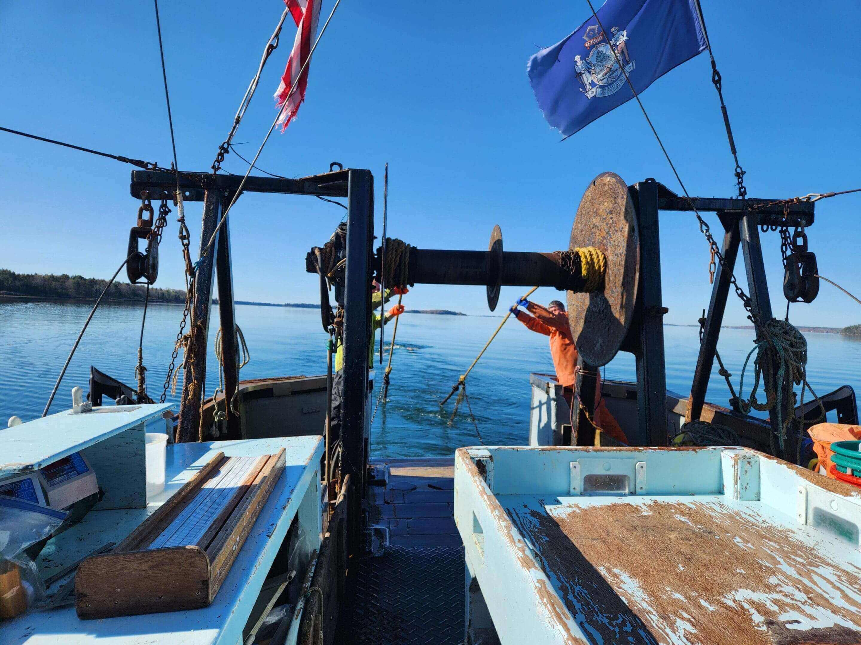
The net used in this project is a modified version of a Maine shrimp trawl designed to fish effectively for a variety of benthic species; net tapers are cut to permit maximum height and tight bottom coverage. The footrope measures 70 feet with a roller frame of 6-inch rubber disks, a 10-foot bosom section with 8-inch disks, and a headrope of 59 feet. It has 2-inch stretched measure polyethylene mesh overall with a 1-inch stretched mesh liner in the cod end. The ground gear is comprised of 60-foot top legs and 60-foot cookie covered bottom legs. The doors are #7.5 Bison steel trawl doors. It is designed to be towed by vessels 45’ to 70’ in length with nominal horsepower. Nets are replaced as needed to keep the gear in good working condition and ensure consistency. A detailed manual of the net design was prepared by the Marine Institute at Memorial University, St. John’s, Newfoundland, Canada and is available upon request.
Survey Operations
Before the beginning of each survey mailings and emails are sent out to fixed gear industry members to alert them of the survey. These mailings include information on the survey schedule and where tow locations are so industry members can move any gear in the location of proposed tows. Without this communication many tow sites may be dropped due to fixed gear being in the tow lines for each survey. Maps of the survey schedule and tow locations are posted on the DMR website prior to each survey for industry members to access.
A standard tow consists of towing the research net for twenty minutes at 2.5 knots in as straight a line as possible. Shorter tows are accepted if the tow has to be shortened due to bad bottom or fixed gear in part of the tow. However, tows under 12 minutes are not accepted and are redone if possible. Information on tow start and stop coordinates, depths, tow direction, weather, amount of wire deployed, time of tow, and tow length are collected at each station.
At each station, the net is brought on board and all fish are identified and sorted by species and aggregate weights are taken for each species caught in a tow. A CTD profiler is deployed to collect temperature and salinity data. In 2021 new sensors were added to the SeaBird CTD and from 2021 on dissolved oxygen, fluorescence, pH, and chlorophyll a are all collected at each site in addition to temperature and salinity. Collective weights are taken for all species. Lengths are taken on each individual unless the samples for that species are so large that they cannot be processed before the next tow. For large samples (e.g. herring) a representative sub-sample is taken of at least one hundred (100) individuals. If a subsample is taken on a species and there are clear differences in size classes occurring that species is separated into different size classes and each size class is treated and processed as a separate catch. Sex and maturity stage of individuals are determined for selected groundfish species using the methods described in (Burnett et al.,1989). Lobsters are immediately separated and processed for total weights (by sex), carapace length (mm), shell condition, presence and stage of eggs, V-notch condition, and trawl damage. Crabs and squid are sampled for length and aggregate weight. Scallops are measured for shell height (mm) and urchins for test diameter (mm). Other invertebrates are identified, counted, and collectively weighed.
With so many factors affecting net performance and thus quality of sampling effort, eSonar, Inc. system net mensuration equipment is employed throughout each survey to document trawl configuration. In addition to addressing the need for quality assurance, the eSonar, Inc. data can be analyzed later in the lab to assess differences in sampling performance between tows. Additionally, the area swept and sampled by the trawl can be calculated from these data which, when coupled with bottom hardness data collected by the survey, may allow for future fine-scale analyses of fish habitat ecology. All analysis on eSonar data is now processed through R script developed by trawl survey staff.

Biological Measures
Selected finfish species may be examined for maturity, individual weight (in grams), diet analysis, and hard parts are collected for aging. The chief scientist determines what species and number of samples to process in each survey. When a maturity sample is processed, a sub-sample of ~25 individuals that consists of at least one fish per centimeter of lengths present is examined. All sexual maturity stages are determined as described in (Burnett et al., 1989). Otoliths are placed in a small envelope marked with the following information: Date, region, Tow ID, grid, fish length, weight (in grams), and sexual maturity. Otoliths are processed and aged back at the West Boothbay Harbor lab of Maine Department of Marine Resources.
Data Management
All station data are recorded electronically in a data collection app and includes detailed information about each tow including, but not limited to, start and ending coordinates, times, depths, trawl wire deployed, weather conditions, and direction of the tow. Notes and comments on each tow are recorded in on the electronic app and in a logbook on the vessel to keep track of any additional information for each tow. All individual species/catch information is also recorded on data sheets. Additional sheets are used for sex, maturity, and stomach analysis data. Lobster data are recorded on voice recorders for later transcribing.
At the end of each survey, all data from each survey are entered and uploaded into the DMR’s Oracle database (MARVIN). Before uploading to MARVIN, all data undergoes data quality checks to assure accurate data is being uploaded for each survey. Tow locations are displayed in Arc MapTM, checked for accuracy, and adjusted as needed during the proofing stage. Data on the cruise forms for each tow is proofread by one of the scientific crew to identify and correct errors before data entry. Raw catch data (collected via trawl log or recorder) are entered into a Microsoft AccessTM database immediately following each cruise by the trawl survey scientists or additional DMR staff. Species are identified by the numeric code system used by the National Marine Fisheries Service. After entry, the data are proofread and edited again, then uploaded into DMR’s Oracle database. Environmental data is downloaded from the CTD into CNV files, converted into text files, and then uploaded into the Oracle database. The eSonar, Inc. data are cleaned of erroneous values and kept in Excel files. All final data are available to end users either by request or from viewing the data portal on Maine DMR’s website.
Requesting Data
Data can be downloaded from our MENH survey data portal located on the Maine DMR website or from the link listed below. Specific data requests or questions can also go to the survey program lead or the marine resource scientist I.


Contact Information
MENH Survey Program Lead, Marine Resource Scientist III: Robyn Linner
Marine Resource Scientist I: Benjamin LaFreniere
Maine Department of Marine Resources
Data Portal
